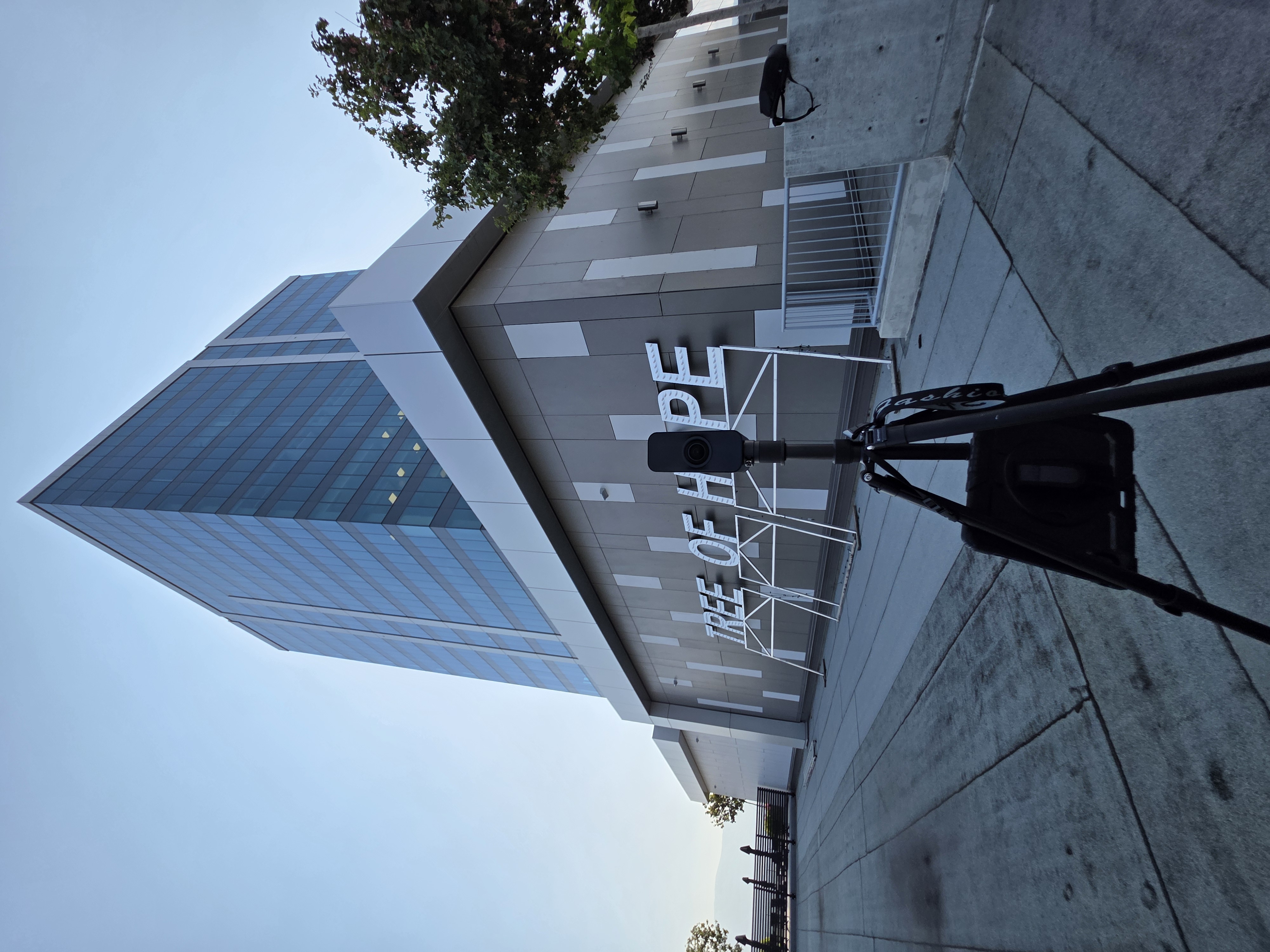
Scan to CAD / BIM
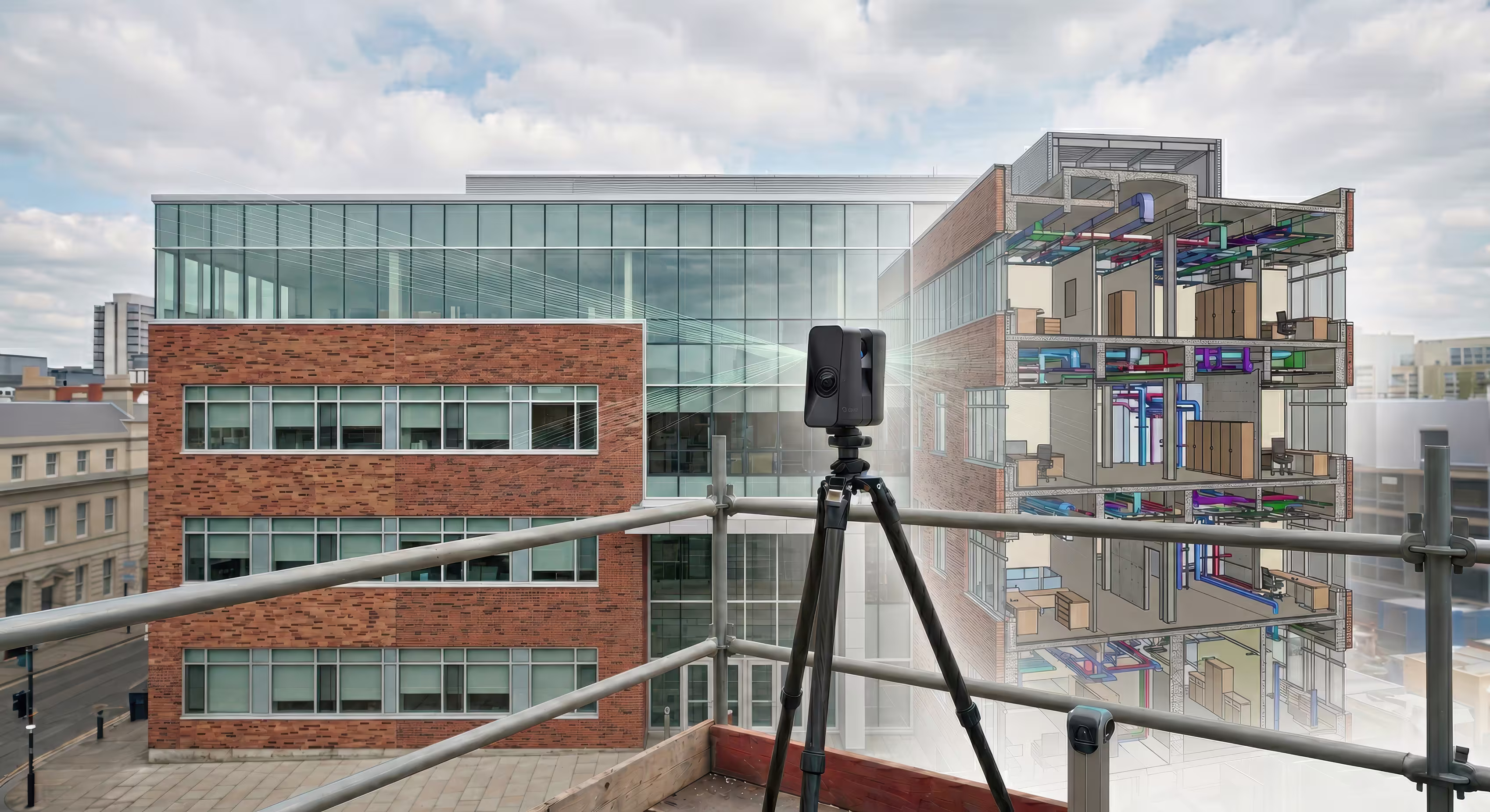
Know What's Really There
A More Accurate Starting Point
Better Renovation and Upgrade Planning
Shared Reference Across Teams
Multiple Outputs From One Capture
Bad building information slows everything down
Built for teams that need better existing-condition data
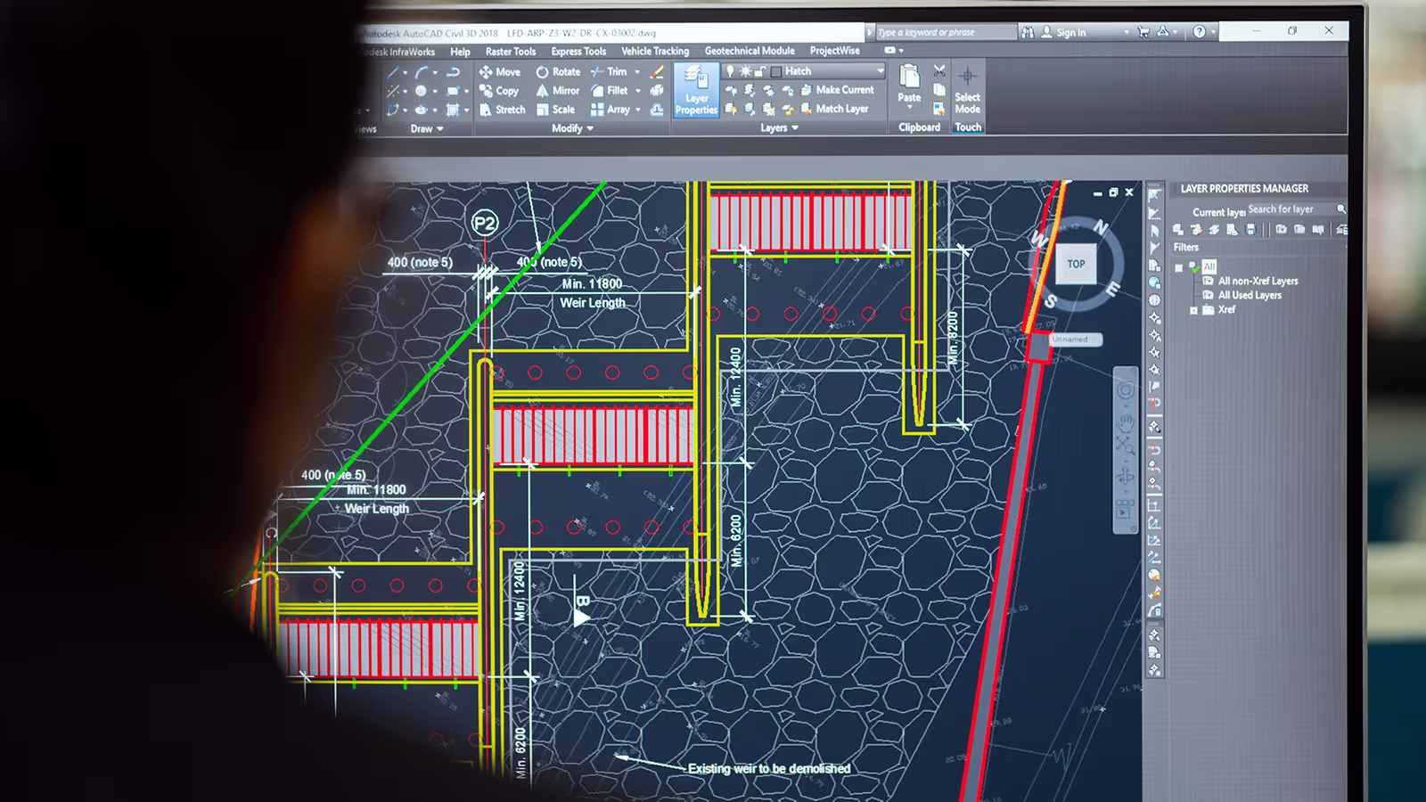
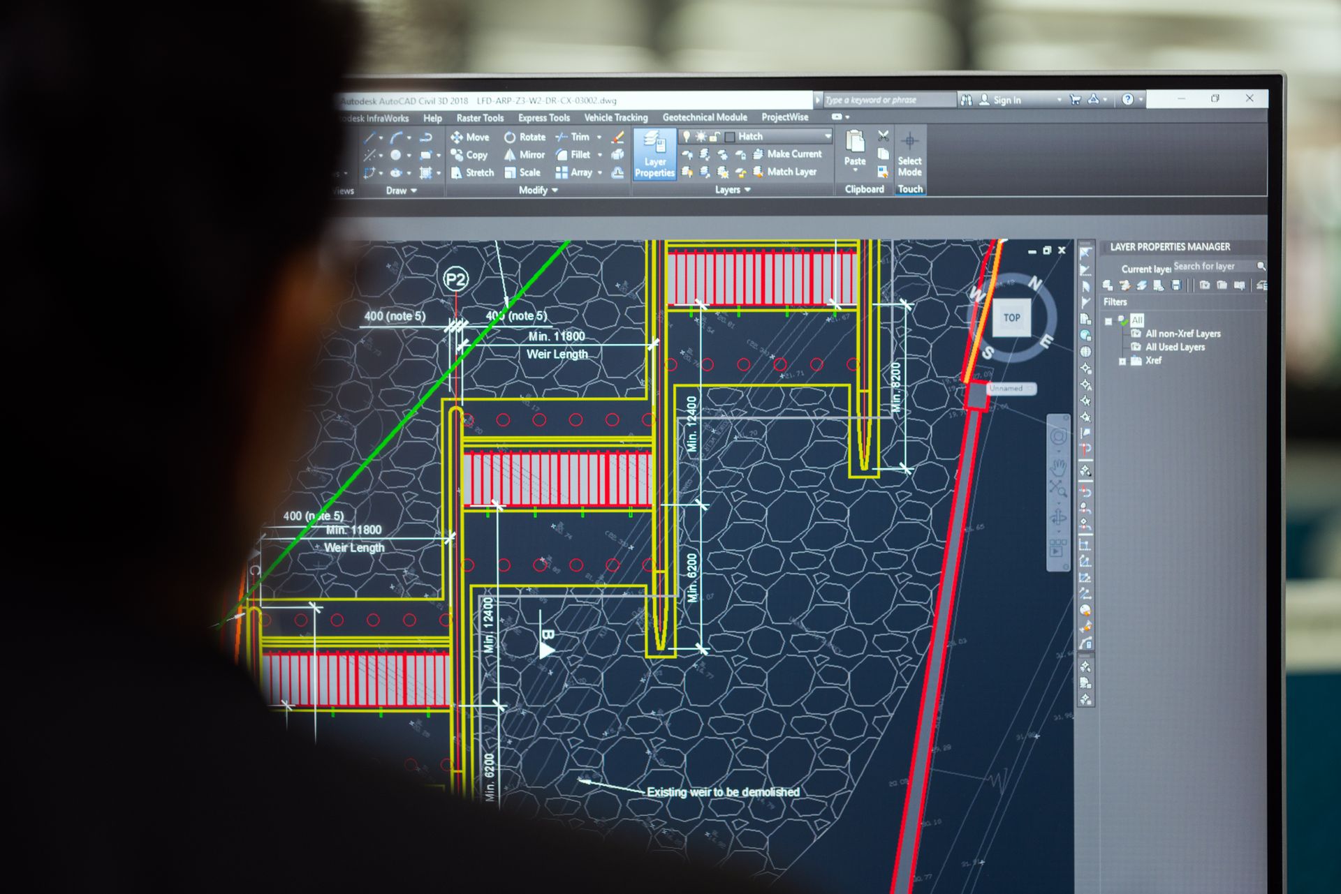
Updated CAD Record Drawings

Revit / BIM Models
Existing-Condition Documentation
Renovation & Retrofit Readiness
Digital 3D Walkthroughs
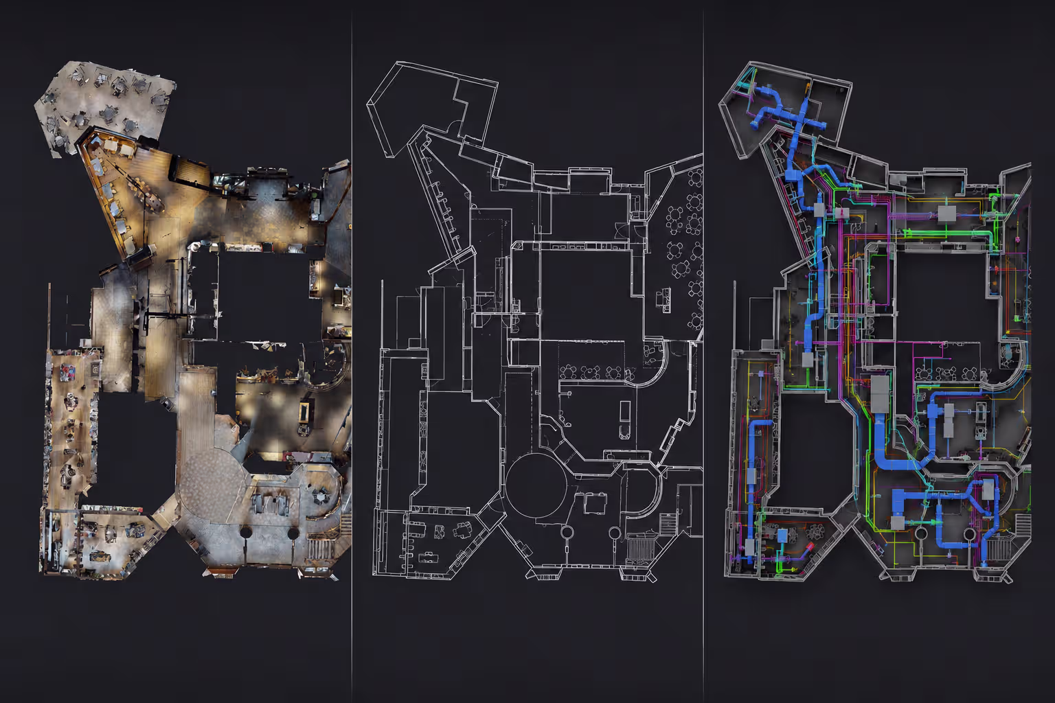
One Capture, Multiple Outputs
See how a clearer baseline replaces decades of guesswork
How It Works
We define what spaces need to be captured, what outputs are required, and how your team will use them.
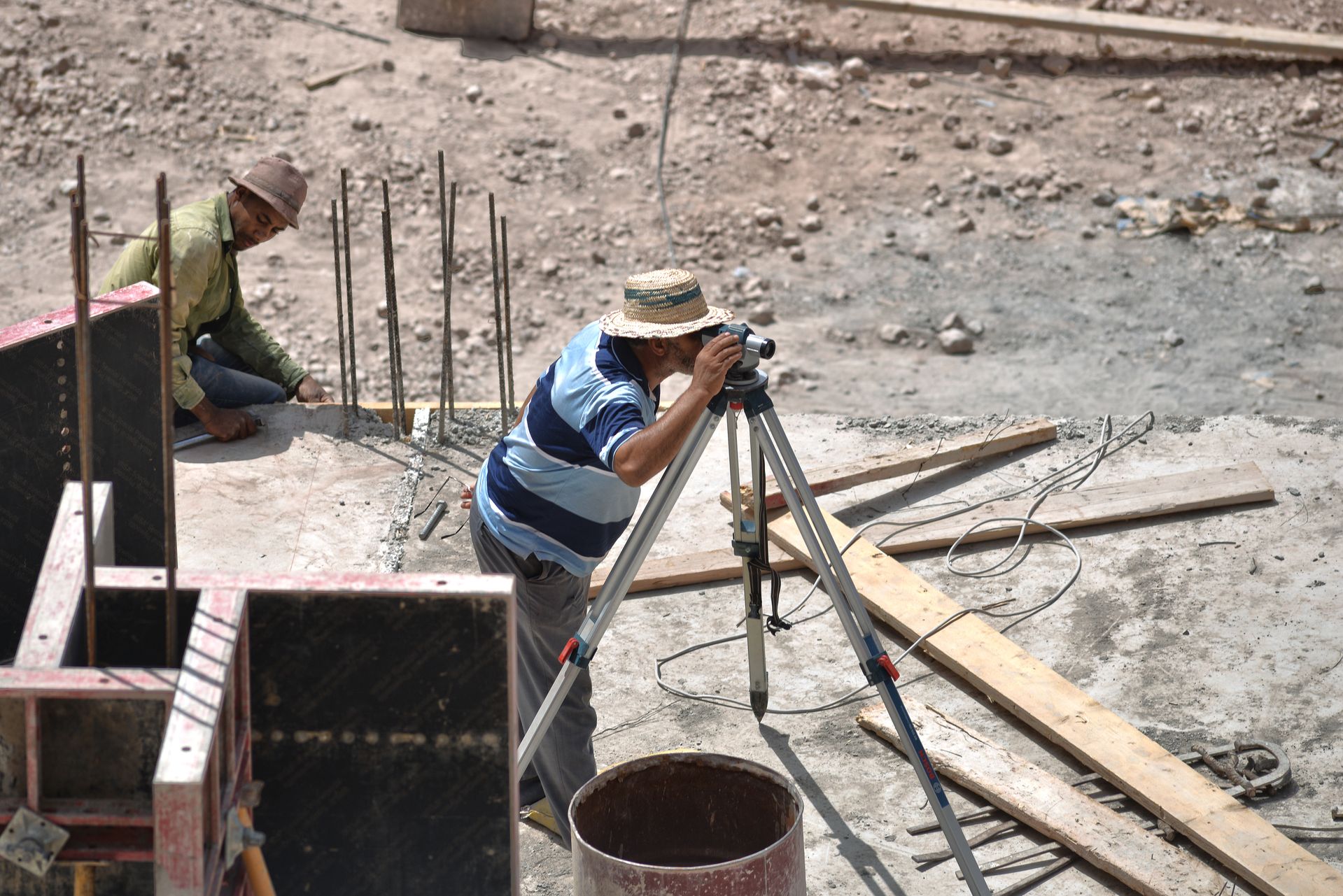
We plan the site capture around the building, campus, portfolio, or project scope.
We scan the existing space to collect the underlying spatial data.
We turn that data into the agreed outputs, whether that is CAD, Revit/BIM, walkthroughs, or a combination.
You receive a clearer digital baseline your team can use for planning, coordination, documentation, and future work.


What our Costumers say

Lorem ipsum dolor sit amet, consectetur adipiscing elit, sed do eiusmod tempor incididunt ut labore et dolore magna aliqua. Ut enim ad minim veniam, quis nostrud exercitation ullamco laboris nisi ut aliquip ex ea commodo consequat.
Lorem ipsum dolor sit amet, consectetur adipiscing elit, sed do eiusmod tempor incididunt ut labore et dolore magna aliqua. Ut enim ad minim veniam, quis nostrud exercitation ullamco laboris nisi ut aliquip ex ea commodo consequat.

Lorem ipsum dolor sit amet, consectetur adipiscing elit, sed do eiusmod tempor incididunt ut labore et dolore magna aliqua. Ut enim ad minim veniam, quis nostrud exercitation ullamco laboris nisi ut aliquip ex ea commodo consequat.